Phase 1: Catchment geomorphology and preliminary sediment budget
 This research has been funded by Seqwater with LBCCG providing support – landholder engagement, site selection assistance and negotiating property access.

- The catchment of Lake Baroon Pocket is 75 km2 or 7,500 ha in area. The primary landuse is cattle grazing and intensive dairying. The catchment has been extensively cleared with only 17% of the original subtropical rainforest remaining. Elevation ranges from 561 m at the top of the catchment to 217 m at Lake Baroon. The width of Obi Obi Creek varies from 10 m near Maleny to 20 m in the lower reaches above Lake Baroon.
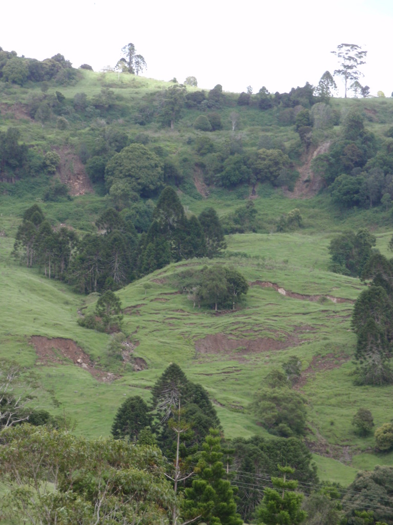
- On the basis of the extent and type of erosion, the catchment can be divided into two distinct areas. These differences result from differences in geology, soil type and slope angle:
- Plateau: Extensively cleared, erosion sources are primarily sheetwash associated with high grazing densities, and the concentration of dairy cattle along regularly used routes
- Gorge: Active mass movement of soil creep and landslip is evident on steeper slopes in cleared areas composed of basalt-derived hillslope debris that forms extensive colluvial mantles in valley bottoms and at the base of benches
- Geomorphic analysis and a preliminary sediment budget suggest that landslide and hillslope erosion provide most of the mobile sediment in the catchment.
- Results show that sediment supply is dominated by sub-catchments close to Lake Baroon. The 10 highest yielding subcatchments comprise ~30% of the total catchment area but supply ~75% of the sediment load. The next ranked 10 cover a further 10% of the total catchment area and supply 10% of the load. Approximately 85% of the sediment leaving the Lake Baroon catchment comes from 40% of the catchment area mostly in the lower river reaches.
- Landslide erosion appears to contribute ~3,260 t/yr of fine sediment to the stream network each year, hillslope erosion ~760 t/yr, channel bank erosion ~310 t/yr, and ~8 t/yr is deposited on floodplains, which mostly occur in lower Bridge Creek. The net export from the catchment is predicted to be ~4,300 t/yr.
- Radionuclide concentrations in fine sediment collected over the last year will be
used to test these budget predictions.